Crotty Geospatial

Apps and analysis, built by a geographer.

Crotty Geospatial is the studio of Sean Crotty, a geography professor at TCU. It makes two things: consumer apps that put a map to work, and consulting that brings GIS and geographic thinking to the way organizations operate and decide.

Fort Worth, Texas 32.7555° N, 97.3308° W Datum NAD83 · Contour interval 20 ft
01234 km

Apps

Software with a sense of place.

RockSteady

Available now · iPhone + Apple Watch

Fitness tracking for the long haul.

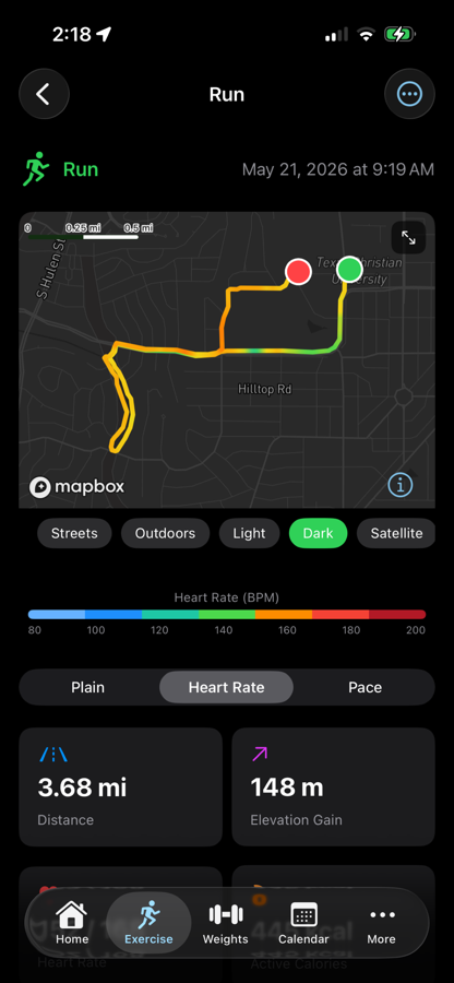
Strength, cardio, recovery and sport in one calm place. GPS routes for runs, rides and rucks, timers for everything indoors, and a Watch app that works on its own. Your data stays on your device.

RockSteady live GPS tracking screen
RockSteady sloth mascot

Erato

Coming soon · iOS + Android

Learn the world the way geographers do: on an unlabeled map.

Find-on-map and name-the-feature questions across more than 15,000 countries, states, cities, rivers, lakes, seas and landforms. Guided practice, mixed sessions, a daily challenge and spaced review. Your progress is a mastery map of the world that fills in as you learn. Built first for World Regional Geography courses, with packs instructors share by code. Works offline. No account, no tracking.

Named for Eratosthenes, the Greek scholar who measured the Earth's circumference and gave geography its name.
Find on the mapStrait of Gibraltar

Preview, not a screenshot

Consulting

Applied geography for organizations.

Every business and organization has a geography: where its customers, suppliers, sites and people are, and how those locations shape what it can do. I help businesses, nonprofits and public agencies see those patterns and act on them, using GIS and geographic thinking to make decisions that improve efficiency, effectiveness and, ultimately, profitability. Place matters, but it is never just one place.

Spatial analysis and location intelligence

Market, site and service-area analysis, customer and workforce geographies, supply and logistics networks, built from census, LODES and your own operational data.

Interactive maps and data storytelling

Web maps, StoryMaps and dashboards that explain a place to the people who make decisions about it.

Decision-support tools

Lightweight, self-hosted tools that give community groups reliable public data without a GIS department.

Selected work
ProjectScope
Economic Development ObservatoryInteractive mapping of neighborhood demographics and economy for Near Southside Inc. and the Hemphill Corridor Development Collaborative, Fort Worth.
Fort Worth Chamber of Commerce StoryMapGeospatial storytelling for regional business recruitment, built with a student team from Supply Chain, Geography and Real Estate.
Patagonia Books climate StoryMapsLed the student team that produced two immersive StoryMaps promoting Patagonia's 2024–25 environmental book releases.
Sanborn GeoDBA searchable archive of georeferenced Sanborn fire-insurance maps for urban historical research.

About

Sean Crotty

Sean Crotty is Associate Professor of Geography at Texas Christian University. His research maps the informal and illicit economies of American cities; his consulting brings the same methods to organizations that need to understand a place. He teaches GIS, economic geography and World Regional Geography, which is where Erato came from.

hello@crottygeospatial.com

Let's talk about your project.

Share a short summary of what you're working on and your timeline. We'll respond with next steps.